The Route Overview
There is perhaps no drive in the United States that commands the same immediate recognition as California’s State Route 1, widely known as the Pacific Coast Highway (PCH). Stretching from the northern redwoods of Mendocino County down through the sun-bleached beaches of Orange County, the route is a staggering 656 miles of almost uninterrupted geographical spectacle. It is a road that dictates your pace. Attempting to rush the PCH is both dangerous and entirely misses the philosophical point of the journey.
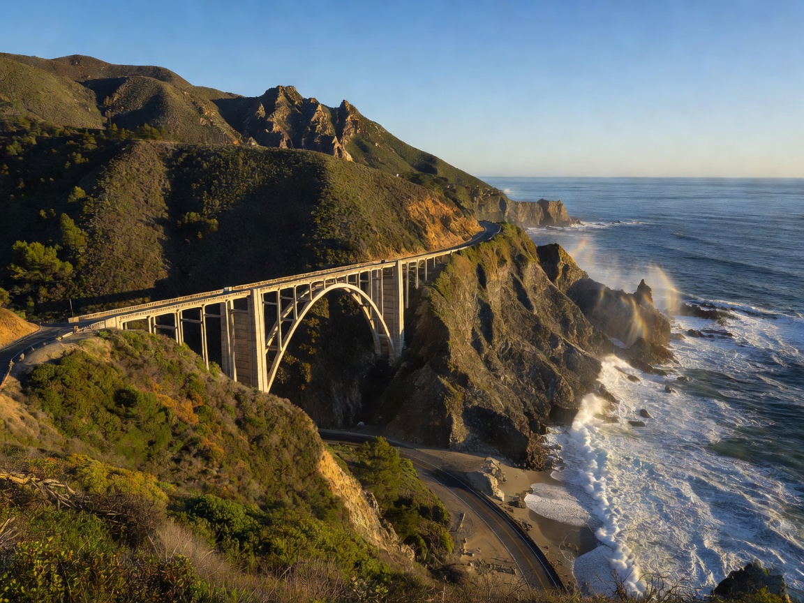
While the entire highway is monumental, the undeniable crown jewel is the section passing through Big Sur. Between Carmel-by-the-Sea and San Simeon, the Santa Lucia Mountains abruptly collapse into the Pacific Ocean. Here, the road clings to the cliffside in a series of serpentine bends, dramatic ascents, and plunging descents. The engineering required to forge this path in the 1930s remains astonishing.
Vehicle Specifications & Recommendations
The PCH is entirely paved, so off-road capability is largely unnecessary unless you plan to venture deep into the national forests alongside the route. However, handling and braking are paramount. The road features hundreds of tight corners and significant elevation changes. A vehicle with precise steering and responsive brakes is highly recommended to manage the constant deceleration required before tight cliffside bends.
While an open-top sports car represents the romantic ideal, practicality should not be ignored. Fog is a frequent companion along the Californian coast, particularly in the summer months, and temperatures can drop significantly as you cross elevated passes. A comfortable grand tourer or a premium SUV with panoramic windows offers the best balance of visibility, comfort for multiple days of driving, and climate control.
Pros and Cons of the Drive
The Benefits
- Unmatched, uninterrupted coastal panoramas spanning hundreds of miles.
- Exceptional infrastructure with frequent, well-marked turnouts for photography.
- A high density of state parks, beaches, and historic towns spaced perfectly for daily stops.
The Drawbacks
- Extreme congestion during peak summer months, severely limiting driving pleasure.
- Frequent road closures due to mudslides and cliff erosion, particularly after winter rains.
- A general lack of cell service throughout the Big Sur region.
Key Viewpoints and Essential Stops
The architecture of the road itself provides several key landmarks. The Bixby Creek Bridge is arguably the most photographed bridge on the West Coast, completed in 1932. Stopping at the designated pullouts before crossing is practically mandatory. Further south, McWay Falls offers an almost surreal visual: an 80-foot waterfall plunging directly onto a pristine, inaccessible beach (or directly into the ocean, depending on the tide).
Beyond the natural vistas, Hearst Castle in San Simeon serves as a fascinating historical detour. The opulent estate provides a stark architectural contrast to the wild coastline surrounding it. In the north, Point Reyes National Seashore offers a rugged, windswept alternative to the manicured beaches of Southern California, complete with dramatic lighthouses and frequent whale sightings.
Seasonal Planning
Timing your drive on the PCH is arguably the most critical decision you will make. While California is famous for its sunshine, the coast operates under its own microclimate. During July and August, a meteorological phenomenon known as the "marine layer" often blankets the coastline in thick, gray fog until mid-day. This effectively obscures the very views you have traveled to see.
The optimal driving windows are typically found in the shoulder seasons: September through early November, and April through May. The autumn months, in particular, offer the highest probability of clear skies, manageable traffic, and mild temperatures. Winter driving is entirely feasible but requires vigilance, as Pacific storms frequently batter the coast, resulting in the aforementioned landslides and road closures. Regardless of the season, checking state highway advisory boards immediately prior to your departure is absolutely essential for a safe transit.