The Route Overview
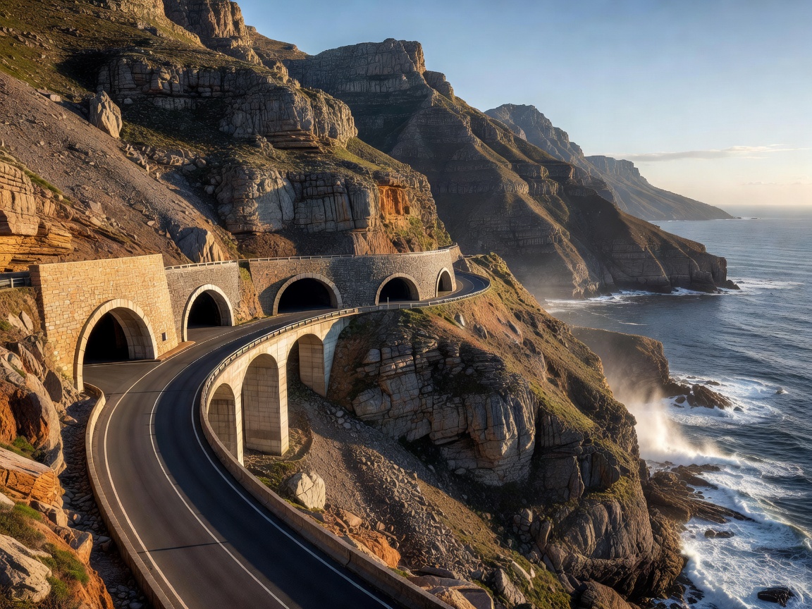
Connecting the coastal suburbs of Hout Bay and Noordhoek, Chapman’s Peak Drive is an incredibly concentrated dose of driving perfection. While it measures only 5.5 miles in length, the road incorporates an astonishing 114 curves. It skirts the rocky flank of Chapman's Peak, a 1,946-foot mountain that plunges vertically into the Atlantic Ocean. To drive it is to witness a triumph of civil engineering over utterly hostile topography.
Construction of the route began in 1915, utilizing convict labor to hack a ledge into the near-vertical sedimentary rock. Today, it operates as a toll road, the funds from which maintain the highly sophisticated rockfall protection systems—including catch fences and half-tunnels—that make the drive viable. It is a slow, methodical drive, designed entirely for visual consumption rather than outright speed.
Vehicle Specifications & Recommendations
Given the incredibly short distance and low speed limit, outright performance is largely irrelevant on Chapman’s Peak. The focus here is entirely on visibility and sensory engagement. A convertible or a vehicle with a panoramic sunroof is the definitive choice. The towering, overhanging rock faces on the inland side are just as impressive as the sweeping ocean views on the outbound side, and a closed roof obscures half the spectacle.
If you are exploring the wider Cape Peninsula (which this route anchors), a sturdy SUV or crossover provides an excellent vantage point over the low stone parapets. However, cyclists are incredibly common on this stretch of road. A vehicle with excellent outward visibility and precise, low-speed steering is essential to ensure a safe distance is maintained when overtaking riders on the blind corners.
Pros and Cons of the Drive
The Benefits
- Uninterrupted, elevated views of Hout Bay and the vast expanse of the South Atlantic Ocean.
- Immaculate road surface and meticulously maintained picnic spots and viewing turnouts.
- A perfect integration into a larger day trip circling the Cape of Good Hope.
The Drawbacks
- Frequent, unannounced closures due to high winds, heavy rain, or rockfall risks.
- Extremely short duration; the drive is over almost as quickly as it begins.
- Requires a toll fee, which can cause minor delays at the plazas during peak tourist seasons.
Key Viewpoints and Essential Stops
There are numerous designated pull-offs along the route, but the most essential stop is the Chapman's Point viewing deck, located near the highest point of the road. From here, you have an unobstructed panorama looking back over Hout Bay, with the Sentinel mountain peak rising sharply in the distance. It is one of the most photographed vistas in South Africa.
As you descend towards Noordhoek, the landscape dramatically opens up. The sheer cliffs give way to the vast, flat expanse of Noordhoek Beach, a stretch of blindingly white sand battered by violent surf. The transition from the claustrophobic, rocky ledge of the peak to this immense open horizon is a masterful piece of natural choreography.
Seasonal Planning
The Cape Peninsula experiences a Mediterranean climate, meaning the winters (June to August) are wet and windy. This is the period when Chapman’s Peak Drive is most vulnerable to closure. The rains loosen the sedimentary rock, and the risk of rockfalls triggers the automated closure systems. Checking the official toll road website prior to setting off in winter is absolutely mandatory.
Summer (December to February) brings glorious, clear skies and warm temperatures, but also the infamous "Cape Doctor"—a fierce south-easterly wind. While the wind rarely closes the road, it can make stepping out of the vehicle at viewpoints a bracing experience. The shoulder months of March, April, and November offer the most stable conditions: minimal rain, softer winds, and spectacular sunsets that turn the cliff faces a deep, burning orange.